|
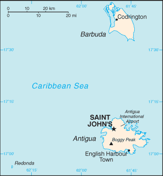
All are close neighbors within the middle of the Leeward Islands, and are located roughly 17 degrees north of the equator. Antigua has a population of 82,000, comprising chiefly a mixture of people of West African, British, and Portuguese descent. The islands of Antigua and Barbuda are part of the Lesser Antilles archipelago. To the south of Antigua and Barbuda lie the islands of Guadeloupe, Dominica, Martinique, Saint Lucia, Saint Vincent and the Grenadines, Barbados, Grenada, and Trinidad and Tobago. Montserrat lies to the southwest; Saint Kitts and Nevis and Saint Eustatius are to the west, and Saint Barthélemy, Saint Martin and Anguilla are to the northwest.[Wikipedia] |
Official name: Antigua and Barbuda Capital: Saint John's (Antigua) Population: 85,632 (July 2009 est.) Area: 442.6 sq km (Antigua 280 sq km; Barbuda 161 sq km) Coastline: 153 km Population density: 155 inhab/ sq Km (July 2005) Religion: Anglican 25.7%, Seventh Day Adventist 12.3%, Pentecostal 10.6%, Moravian 10.5%, Roman Catholic 10.4%, Methodist 7.9%, Baptist 4.9%, Church of God 4.5%, other Christian 5.4%, other 2%, none or unspecified 5.8% (2001 census) Language: English (oficial), local dialects Ethnic groups: black 91%, mixed 4.4%, white 1.7%, other 2.9% (2001 census) Government: Constitutional monarchy with UK-style parliament Currency: East Caribbean dollar |
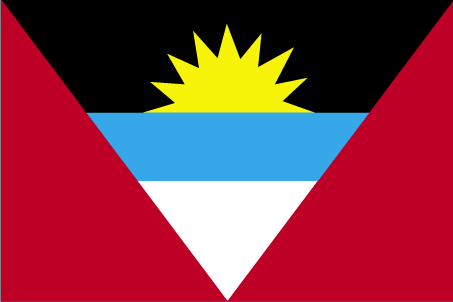
 Antigua and Barbuda (Spanish for "Ancient" and "Bearded") is an island nation located on the eastern boundary of the Caribbean Sea with the Atlantic Ocean. It consists of two major islands — Antigua (pronounced /ænˈtiːɡə/) and Barbuda(/bɑrˈbjuːdə/) — and a number of smaller islets.
Comunicados de prensa más recientes
Islas Caimán, 31 de octubre de 2025. El CCRIF SPC anunció que hará un pago de US$70 millones al Gobierno de Jamaica tras el paso del huracán Melissa. Es el mayor pago único en la historia del CCRIF y una poderosa demostración del modelo de seguro paramétrico de la organización.
Gran Caimán, 18 de diciembre de 2024.